The 0ld Courses of the Yellow River
5 min readThe Secret Anguish of”Saishang-Jiangnan”
Being a river that changes its courses frequently,the Yellow River brought the disasters that were not second to the wars.
The history has recorded some big course changes of the mainstream of the Yellow River in the middle and lower reaches.The river all underwent large course changes in the areas such as Yinchuan Plain and Hetao Plain in the upper reaches,the sections from Yumenkou to Tongguan and from Mengjin to Wuzhi in the middle reaches.
Comparatively speaking,the river course in the lower reaches changed more frequently,each time bringing the people living alongside the river enormous damage,and adding everlasting wound in the Chinese history.
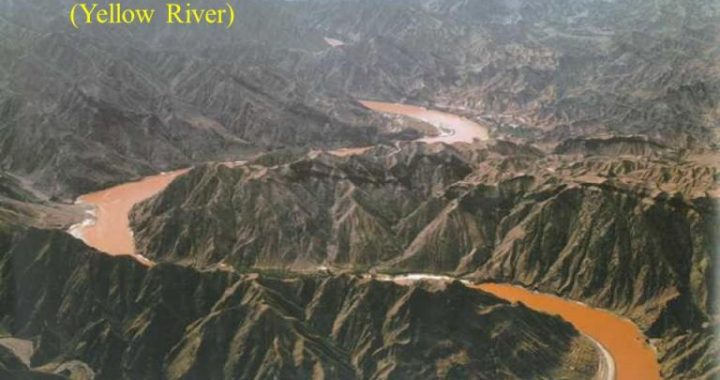
In the upper reaches of the Yellow River,the mainstream course mostly flows through mountains and valleys,which has a stable riverbed and does not changeeasily;however,when the river flows out of Qingtong Gorge and enters Yinchuan Plain and Hetao Plain,the terrain along the river suddenly flattens up,so does the riverbed,thus the torrents slow down and silt and sand are prone to deposit.

Therefore,the two sections of the Yellow River in Yinchuan Plain and Hetao Plain underwent comparatively large course changes.
The development of Yinchuan Plain has a long history.As early as the Western Han dynasty(206 BC-25AD),people began to build canals and channels on the plain that was formed by the deposit of silts in Yellow River and introduced water from the river for irrigation.The originally deserted plain became the famous”Saishang Jiangnan”(area north of the Great Wall as fertile as the region south of theYangtze River)through people’s diligent work and the interweaving irrigation network.
Since the plain was formed by the deposit of silts in the YellowRiver,the banks of both the mainstreamand the tributaries of the Yellow River all have very loose earth.Every time when the flood season comes,large volume of water would accumulate in the river,hence the high water level;and under the frequent erosion of the river water,as time goes by,there appeared serious landslip alongside the river.When the situation was very worse,there would be the phenomenon that the mainstream of the Yellow River changed its course or took over the river course of its tributaries.Therefore,in the history,this section of the mainstream usually would change its course,sometimes eastwards and sometimes westwards,affecting the work and life of local people greatly.
The typical event in the course change of this section was the disappearance of “Lingzhou”.The Debogul俟 Town which was built on the sandbar in the ancient Yellow River(12 kilometers from Lingwu County in Ningxia Hui Autonomous Region in the southwest)in the Northern Wei dynasty(386-584)was then an important military fortress on the western border.Although the sandbar was situated in the middle o the Yellow River,it had never been submerged by the floods for thousands of years.
It shrank or expanded according to the water level,as if it was protected by thegod,therefore people called it”Lingzhou”(meaning it is a divine place).However,in the Tangdynasty(618-907),the sandbar was alreadyconnected with the east bank and Lingzhou Town was close to the east bank too-the mainstream of the Yellow River already moved to the west.
In the Ming dynasty(1368-1644),the Yellow River had major course changes.
Emerging from Qingtong Gorge,the Yellow River flowed to the due east.In 1384,the Yellow River flushed towards Lingzhou Town suddenly and the rampart was rushed down.
The town was destroyed by the enormous water and thousands of people were killed.
The government had to build a new city 3.5 kilometers north to the old town.
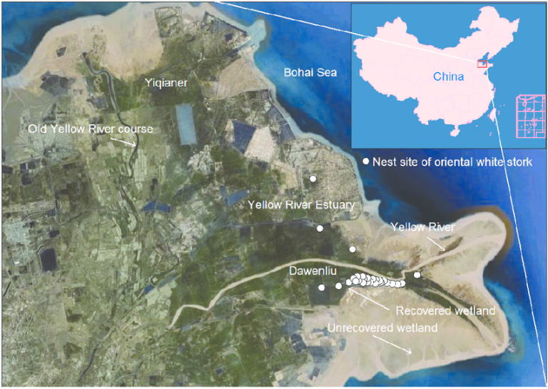
However, the east bank of the Yellow River was breached again in 1428 and the river course moved eastward again, and Lingzhou City had to move accordingly. In 1622, the Yellow River was breached again in this area. Being afraid that the river course would continue to move eastward, the local official Zhang Jiude organized people to build stone levees and with many other measures, they finally induced the YellowRiver to return to its original river course and stopped its tendency in moving eastward.
However, in the early years of Shunzhi’s reign (1644-1662) of the Qing dynasty, the river course moved eastward again, and the floods threatened Lingzhou City directly. This time, the Lingzhou people chose not to stop the flood, but divert it by digging many channels at the west bank of the Yellow River, which, not only protected Lingzhou City from the floods, but also induced the river course to the west. During Qianlong’s reign (1736-1796) of Qing, the watercourse of the Yellow River was over 10 kilometers away fromlingzhou City.
The section of the Yellow River near Lingzhou is in the south part of Yinchuan Plain, while the sections in the middle and north part of the plain often changedtheir courses too, and the latter one is still moving today. This kind of examples was all recorded in detail in many historic literatures about the YellowRiver.
In the southeast of Huinong County of Ningxia Hui Autonomous Region about 5 kilometers away, there is a place called Shengwei, which is on the west bank and about 7.5 kilometers away from the Yellow River. According to the historic records, in the West Xia dynasty (1038-12270), this place was on the east bank and there built a Shengwei City; however, during Qianlong’s reign (1736-1796) of the Qing dynasty, Shengwei City “moved”from the east bank of the Yellow River to the westbank. The city itself didn’t move at all, and the odd phenomenon was caused by the course of the Yellow River moving from the west to the east. Pingluo County in the south of Huinong County is also located on the west bank of the Yellow River andaccording to the records of the local gazetteer in the Ming dynasty (1368-1644), the Qing dynasty (1616-1911) and the Republic of China (1912-1949), the distance between Pingluo County and the bank of the Yellow River was 7.5 kilometers in thelate Ming dynasty (1368-1644) but about 300 years later it became 15 kilometers in the early Republic of China (1912-1949), which showed that the river course had moved greatly to the east in the Qing dynasty (1616-1911). This tendency of moving eastward is still working today.

