The mountains in Xinjiang
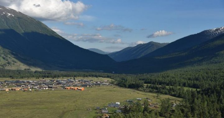
5 min readFriends, have you ever been to Xinjiang? If you enter Xinjiang by the Lan-Xin Railway will you ever be surprised at the rolling snow mountains looming on the horizon? If you fly to Xinjiang, will you ever be amazed and shocked at the continuous and magnificent ice-capped mountains? All high mountains in Xinjiang are natural artworks with their respective charms. The natural phenomenon of “one mountain has four seasons, while with just 10 li(one li equals 500 meters) in between, there would be a quite different weather makes you appreciate the superlative craftsmanship of Mother Nature Yes, Xin jiang has many high mountains whose areas account for 49.5% of the total area The Altai mountains. Tianshan mountains and Kunlun mountains formed the clear patterns of Xinjiang physiognomy. Mountains in Xinjiang are rich in biological resources, water resources, mineral resources and tourism resources. They not only form and reserve the water resources in typical arid area of Xinjiang but also are important mineral nutrients and species repositories, which play an important role in promoting the oasis forming and maintaining the ecological balance in Xinjiang.

Actually, in the Palaeozoic Era(at least 500 million years ago), Xinjiang only had the Junggar and Tarim landmasses encircled by seas With earth crust movement in the Palaeozoic Era, seas gradually subsided. Maybe in the end of the third period of the Cenozoic Era(at least one million years ago), the surrounding sea beds rose and formed the Altai, Tianshan and Kunlun Mountains while the stable Junggar and Tarim land masses turned to be two basins surrounded by the three mountain range Snowy June in Tianshan Mountains.
Altai Mountains lie in the northernmost part of Xinjiang and mean”Gold Mountain”in the Mongolian language. A folk saying goes like this: There are 72 gullies in the Altai Mountains with each gully being full of gold. According to incomplete statistics, a total of 400,000 liang(a unit of weight) of gold was produced in Altai Mountains before the 1950s According to some records in history, the largest”nugget weighing over 240 liang was dug out in the Altai Mountains. The Altai Mountains in China lie on the north of the Irtysh River and the part in Xin jiang is the south slope, which stretches from northwest to southeast with a length of 500km and is relatively low, mainly including the altai mountains in altai City and Qinghe County, Beita Mountains in Qitai County and Mulei Kazakh Autonomous County, and Aermante Mountains in southern Qinghe County; the highest peak–Friendship Peak is 4, 373m above sea level and located on the border of China, Mongolia and Russia The altai mountains are rich in rain and snow, luxuriant grasslands and dense forests with the forest area of 260,000 hectares, a forest coverage rate of 22, 44% and the prairie of 10.53 million hectares. and become the “wet island”in Xin jiang desert area In winter. the altai Mountains are covered and frozen with snow and become the icy world of”snowy forests”; in summer, they are cool and comfortable. The dark green forests with rolling peaks and ridges and the flower sea compose a colorful and beautiful picture. The natural landscape in A poem once written like this: “pines and spruces are towering the flowers and grasses spread the valley”, “peaks vie for beautifulness and rivers flow violently”.

The magnificent and grand Tianshan mountains stretching across the middle of Xinjiang has many peaks and ridges rising one after another and extends from east to west It has a total length of 2, 400km dividing the Junggar Basin and Tarim Basin and is one of high mountain ranges in Asia. The western part of Tianshan Mountains is in Kazakhstan and Kirghizstan and the middle and eastern parts are in Xinjiang with a length of about 1, 700km and width of 200-300km. It is composed of three parallel fold mountains slowing downward from west to east. and the mountains are wide with an average ridge line of over 4,000m. The northern ridges include Alataw Mountains, Keguqin Mountains, Borohoro Mountains. Bogda Mountains. etc: the middle ranges include alakaer Mountains NalatMountains. Aierwengen mountains etc the southern ranges include Keketier mountains Haerlik Mountains Tiersike Mountains. Keketieke Mountains Hora Mountains. etc peaks over 5,000m include Tomor Peak(7, 435m above sea level, the highest peak in TianshanMountains), Khan Tengri (6,995m) and Bogda Peak(5,445m) There are well developed and beautiful forests, prairie and glaciers. Li Bai, the great poet in Tang Dynasty (618 AD to 907 AD) once wrote in a poem: The bright moon rises from the vast and boundless sea cloud ofTianshan mountains There are over 9. 128 various glaciers in Tianshan mountains which is a natural solid reservoir The melted snow water from Tianshan mountains makes over 200 rivers which moisten and irrigate the vast oases in the southern and northern parts of Tianshan Mountains. Basins and valleys are located between the high and steep mountains among which Kumul Basin, Turpan Depression and Ili River Valley are very good natural mountain pastures with fertile land and lush water and grass Kunlun Mountain range in the southern part of Xin jiang spread at the south edge of Tarim Desert, including the Pamirs in China, Karakoram between Xinjiang and Kashmir and Kunlun Mountains between Xin jiang and Tibet from west to east: the north branch also includes Altun Mountains, extending to and connecting Qilian Mountains on the northeastern part. Kunlun Mountains are steep and towering with the average crest line of over 5,000m above sea level. Chogori, the highest peak located on the border between China and Pakistan of 8, 61lm above sea level, is the second highest peak in the world. There are over 10 peaks of 7, 000m above sea level in the Kunlun Mountain Range, such as the Kongur Tagh of 7. 719m Kongur tobe feng of 7.595m and the muztagata which is named “the father of peaks”of 7, 546m. These three peaks are all in Akto County. The terrain of Altun Mountains is low and the peak is in the southeast of Qiemo County, with an elevation of 6303m. Insukati Glacier, the largest glacier in China, also spreads in Kunlun MountainsKunlun Mountains abound in Hotan jade, whose body is like congealed fat, smooth, cleanand very precious. White nephire, in particular, has no equal in this world, In Kunlun Mountains, there are high and low ridges and peaks, dense and remote forests, and the scenery is very beautiful. At the end of spring and the beginning of summer, green trees sprout and flowers bloom to contend in beauty and fascination all over the mountainsmaking Kunlun Mountains more charming. Karakorum Mountains is a large mountain ridge in parallel with Himalayas in Punjab(a part of the Great Himalayas). It extends for about 400km and runs through India and Northern Pakistan, Except the polar regions, the glaciers on this mountain are much more and longer than those in other places of the world. si Biyafu Glacier, the largest glacier(with a length of 100km), goes through the Yisipa Pass Karakoram is sometimes called”Extremely Dangerous Mountains”, because many people have lost lives when attempting to conquer it. There are totally 19 mountains of over 7260m in Karakoram Mountain Range, and these peaks are usually sharp and steep in shapes with hundreds of stone towers and steep peaks in the surrounding. These mountains are the homelands of goats, antelopes, wolves, brown nears and rare snow leopard.


